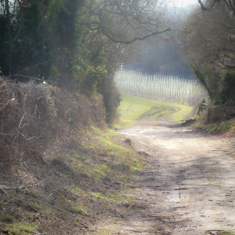
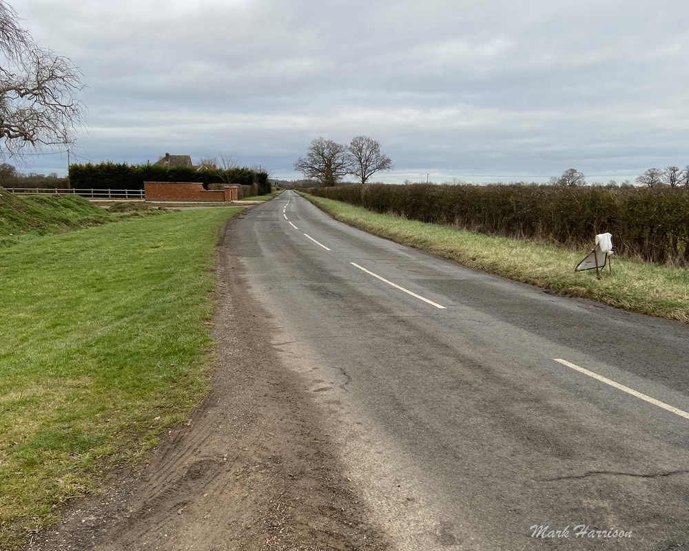
 Above: One of the magical scenes on Puddleduck Lane beckons travellers on the path to Coleshill. No matter how often one traverses the rural part of this route, as long as the environment is respected (and it is) it never ceases to give. We've walked it, cycled it, and no doubt many have ridden it on horseback, and always emerge feeling reinvigorated. Of course, Coleshill being an approximately four-and-a-half mile walk from Faringdon, it is always good to know that the Carpenters Canteen is at the other end (or half-way mark if you intend to walk back afterwards). This lively café serves delicious wholesome food, coffee and sundry other soft drinks (and don't forget the cake)[1]. Just be sure, before setting off, that you've checked the web entry (and perhaps also phoned) to ensure the café is open. It can be busy at popular times, too, so be prepared to wait. Or, if you're the impatient sort, nip across to the Radnor Arms[2]. Deciding on your route There are probably infinite options for getting there but there are essentially three basic ones. As I favour Active Travel[3], I'll allow myself a mild rant while laying out the options:
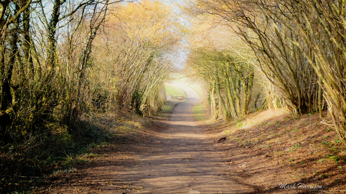
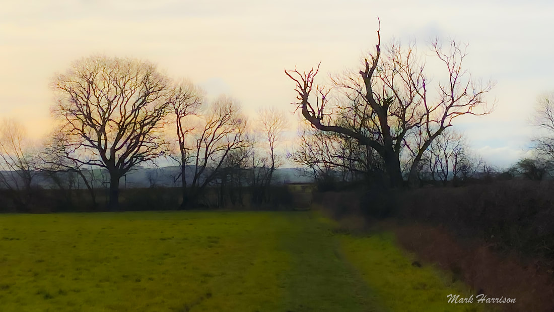
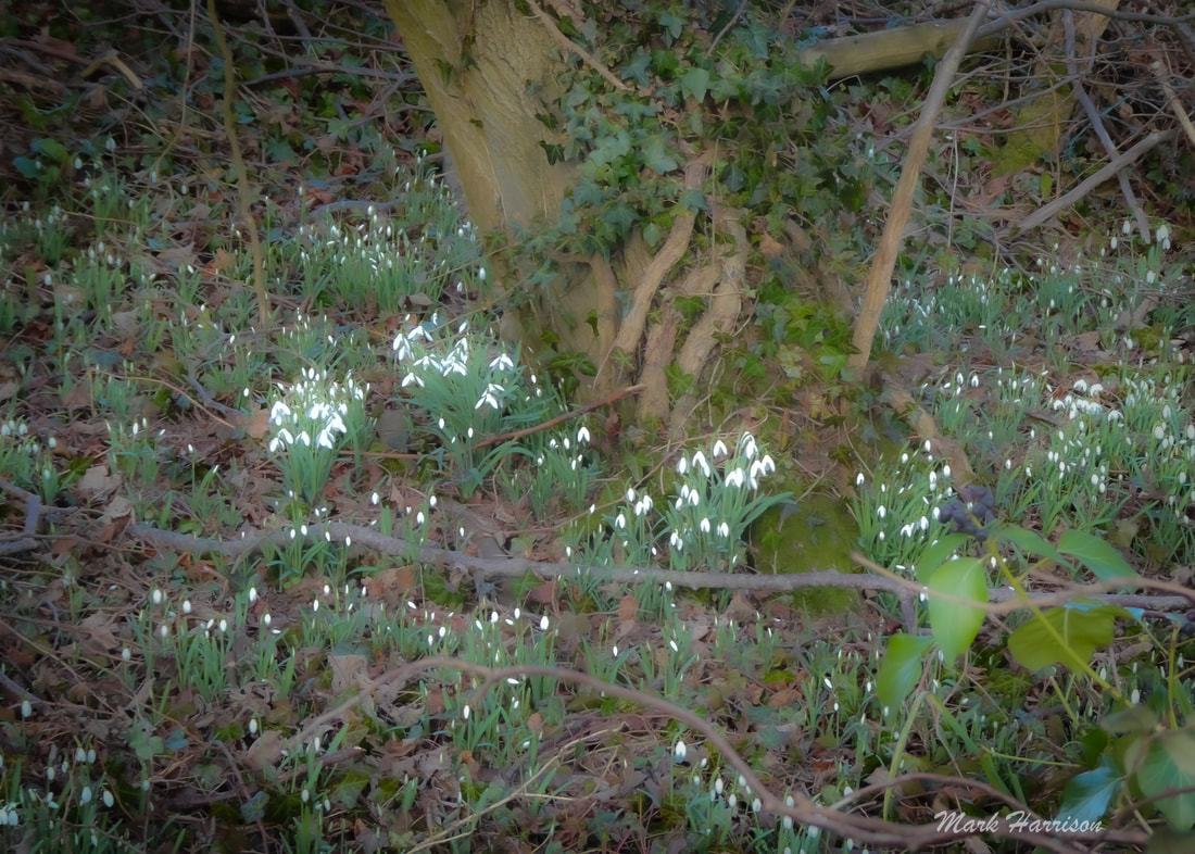
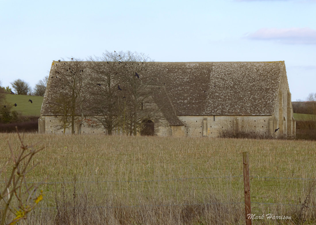
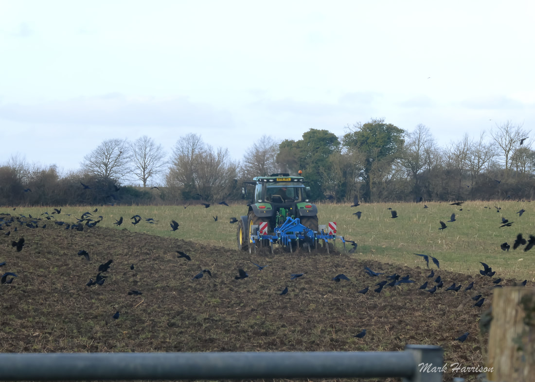
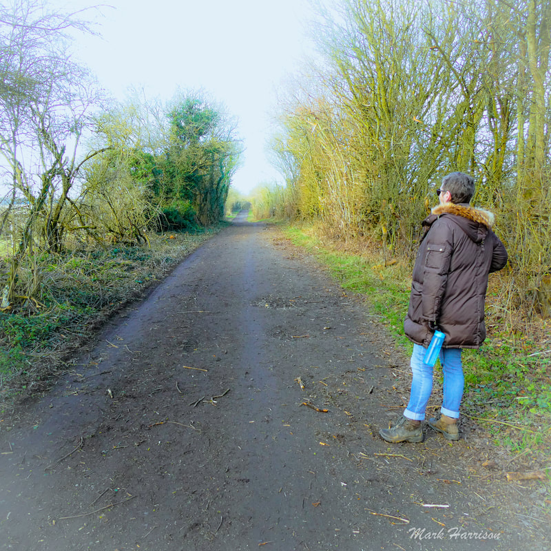
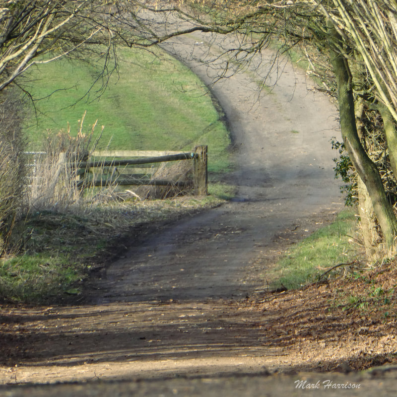
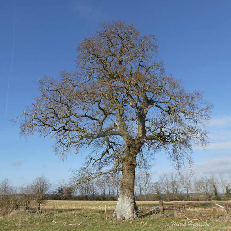
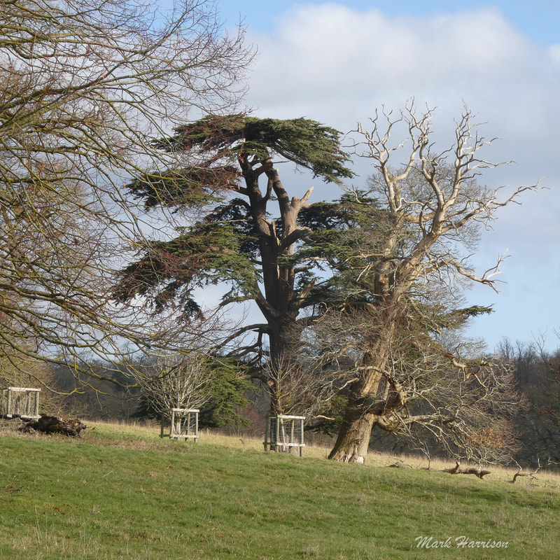
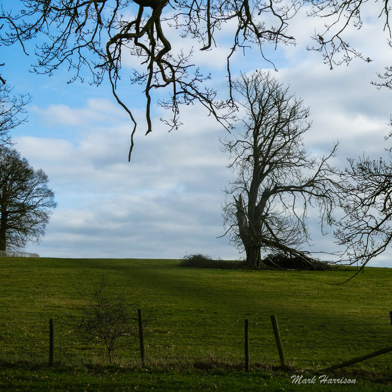
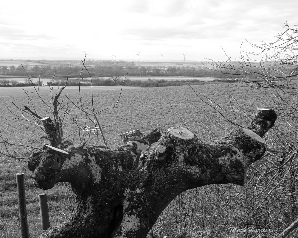
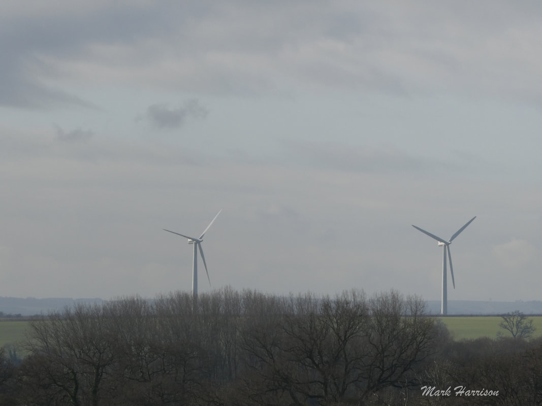
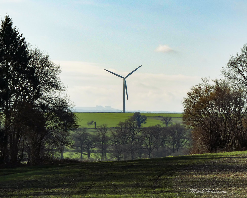
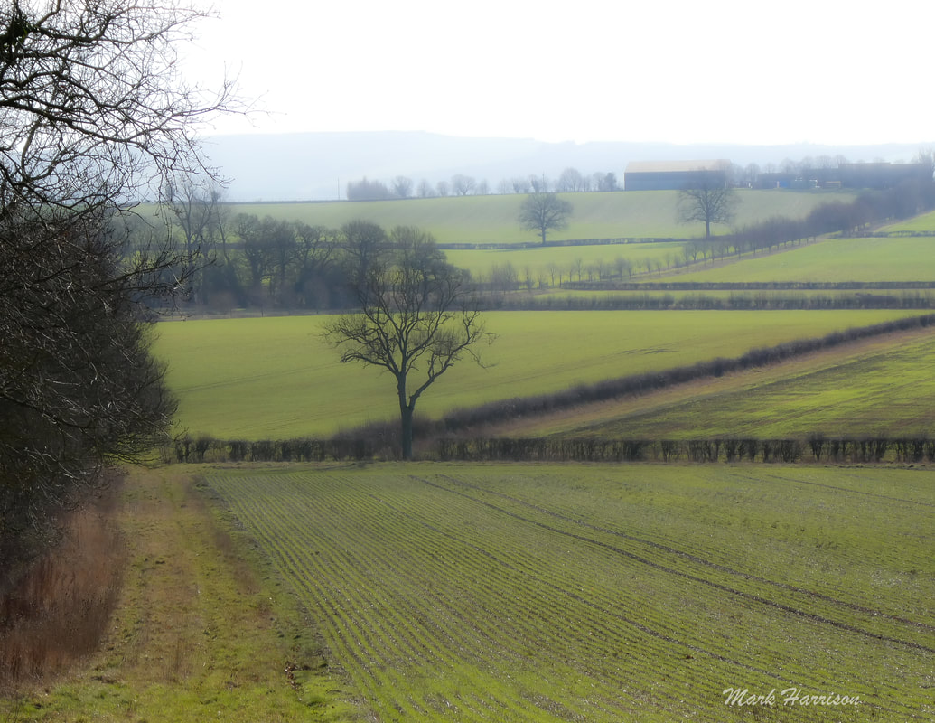
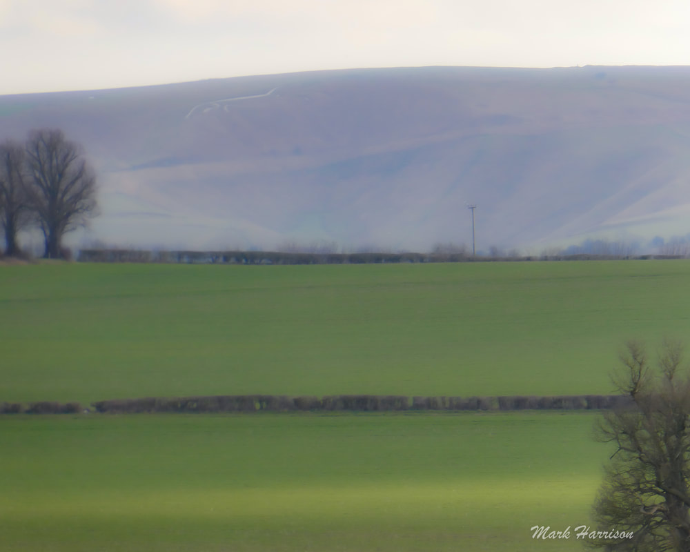
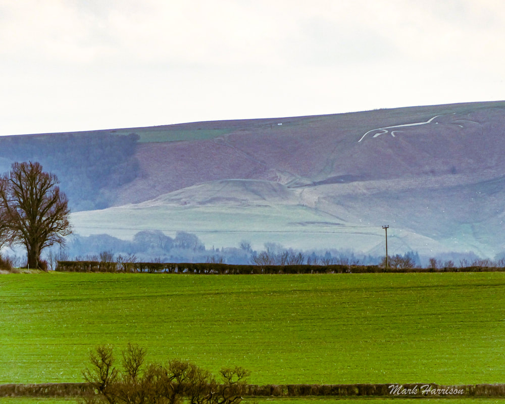
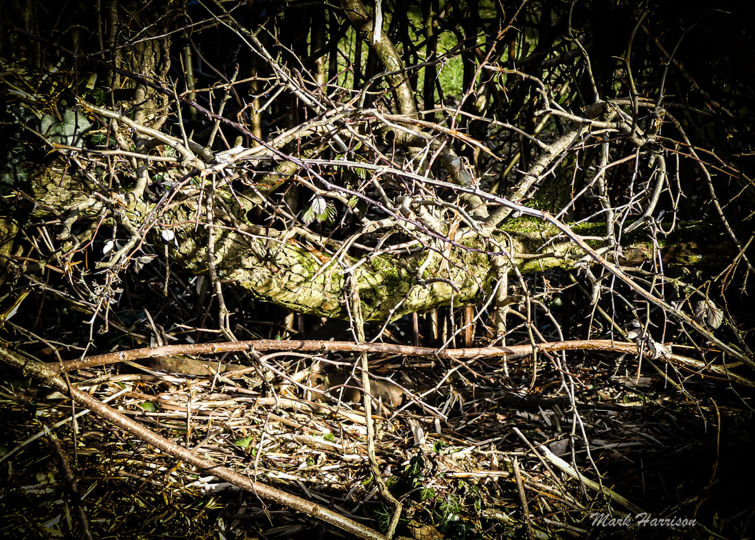
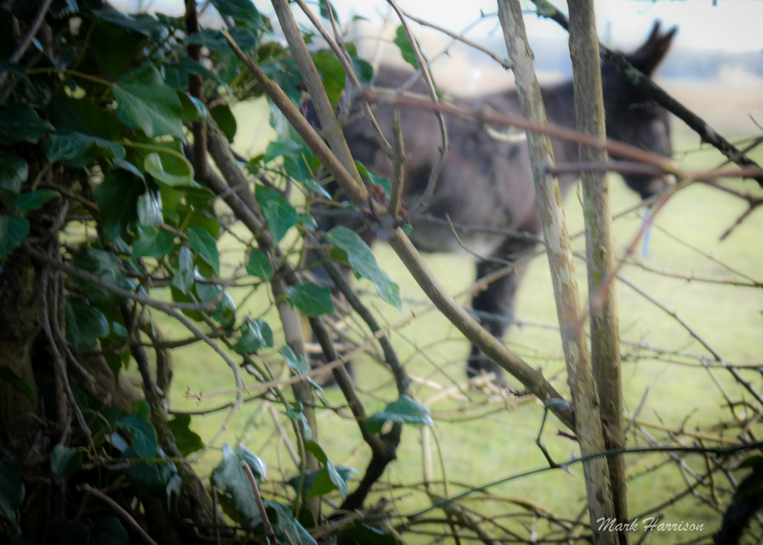
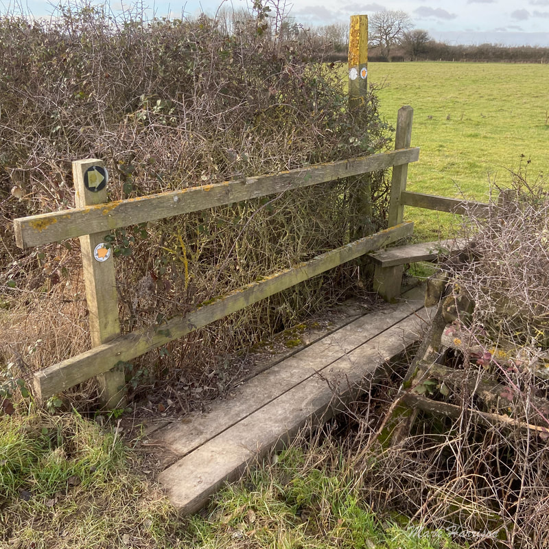
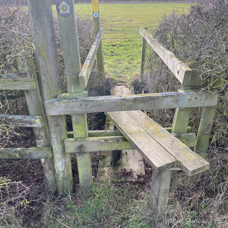
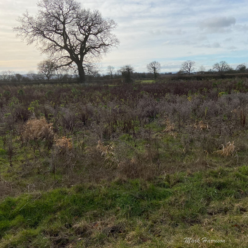
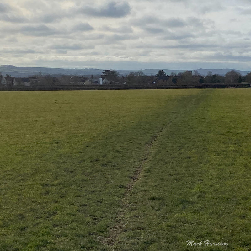
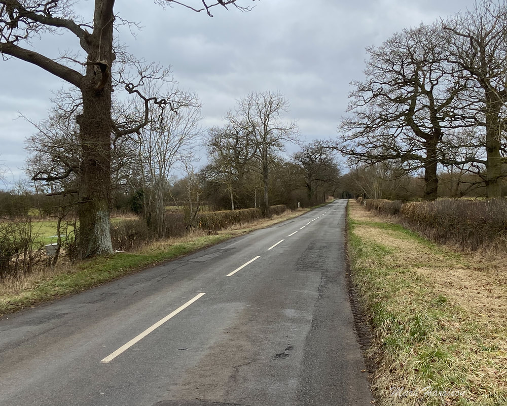
We chose #3 On this day Shelley-ann (Shan) and I set out to walk from Faringdon to Coleshill for lunch. The weather was sublime. Honestly, this route gives; even blizzards add their own dimension. Above, l to r: going the long way around; where seasonal snowdrops abound; a tyhe barn with brooding looks; and tractors play host to rooks. Our route took us South of the B4019 and as walkers we had a footpath along the road to Great Coxwell. We are always struck by the soft light at this time of year Everywhere should have a Puddleduck Lane. Above, l to r: Shan viewing the road ahead; through the tunnels the way led; this last needing a light tread. The Puddleduck section of this route has recently been acquired by Andy Cato, Wildfarmed[5] co-founder, who is "an award-winning mixed arable and livestock farmer. Once a successful Grammy nominated musician, Andy gave that up after reading about the dire state of modern food production. He went on to spend over a decade trying to find a more restorative and sustainable way of growing food." It would be good to think that, one day, we could bump into him and hear more of that vision and plans for the future of the area. Local myth has it that a massive tree planting operation is under way. We'd love to hear more about this having always admired the woods surrounding the Coleshill Parkland. There is certainly substantial evidence of recent tree "husbandry" along this route. Trees Above; Don't'cha just love them? The first one is an icon of Puddleduck and the others are landmarks of the Coleshill Parkland, always needing attention. Long may it continue. Landscape There is a kind of lumpy ridge that connects Faringdon with Coleshill so that most of the time, whether one walks to the North or the South of the B4019, there are magnificent views to be had. To the North there are the Cotswolds and to the South the Berkshire Downs. For most of our walk on the Southern side we could enjoy these stately views. Some might (or indeed do) argue that the wind turbines on a smaller ridge between our walking path and the Downs are an eyesore. I completely disagree. They are simply elegant. They are part of Westmill Farm which had recent connections to Colleymore. Maybe they still have ... Looking further towards the ridge in the background, the lifting haze and deployment of my monster zoom in a small package reveal the prehistoric Uffington White Horse that gives its name to the Vale in between us and to a hearty ale produced in Stanford (in-the-Vale). Above: (top row) the turbines appear closer and closer in all their grandeur; (bottom row) and there is a white horse beyond. Old ways After a sumptuous sandwich each from the Coleshill Canteen, Shan wisely hitched a ride back to Faringdon with friends. I felt the need to drag my aging body back to Faringdon for the exercise. I won't say I regretted it but there was a pair of happy legs that were finally rested with a little over 9 miles under my belt. One of the aspects of farming that has intrigued me in recent years has been hedge laying. A brilliant, if labour intensive, solution to keeping larger animals in their fields with all the green credentials in the world. Most hedges have long since been slashed over winter by tractor-mounted trimmers, removing their potential for restraining the odd bull, sheep or even donkey. There seems to have been a bit of a laying revival in recent years but the uptake is slow - maybe someone will find a labour-saving way to do it. It will surely be welcome by cyclists. The slashings of hawthorn strewn across country roads are a menace to tyres. Above l to r: low-lying branches are evidence of early laying; barbed wire now to keep donkeys staying and braying.
Coming next More routes, perhaps? Endnotes:
4 Comments
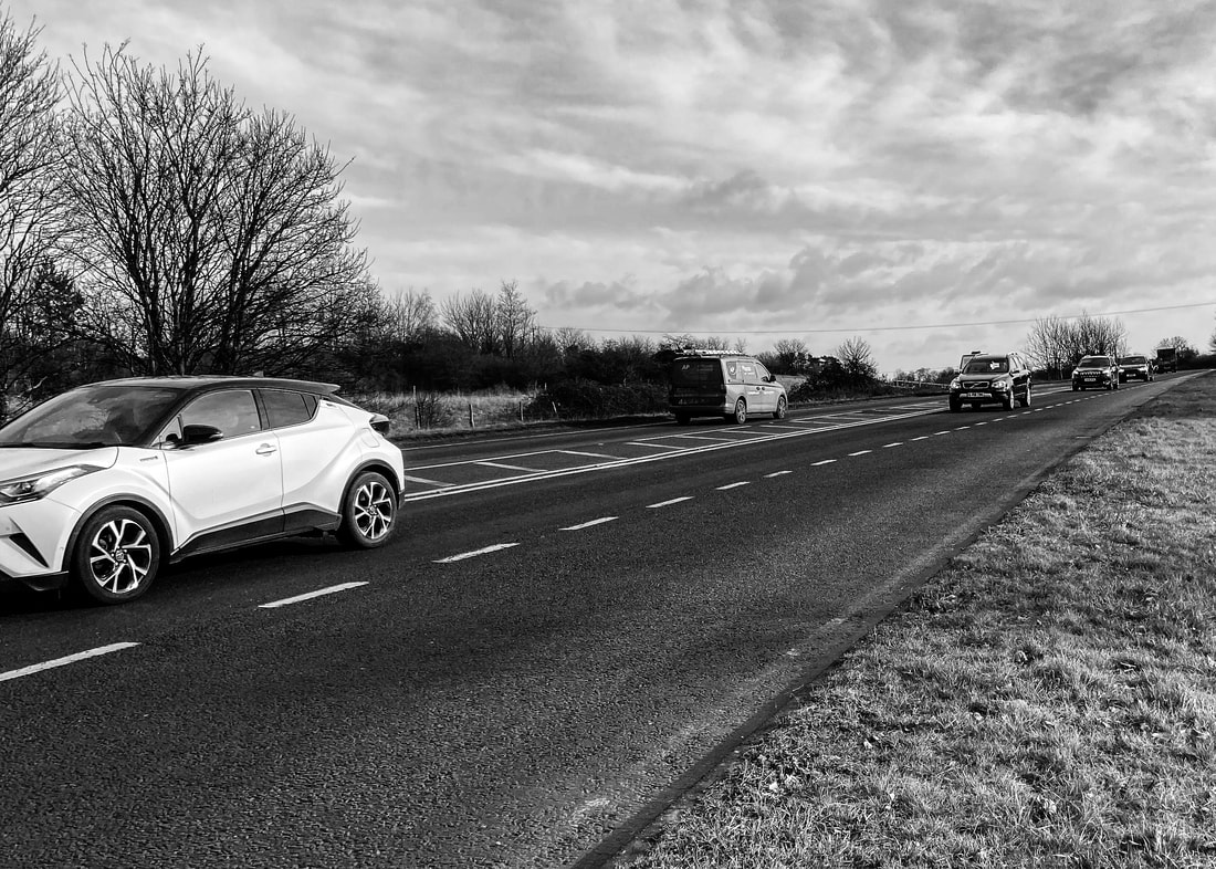
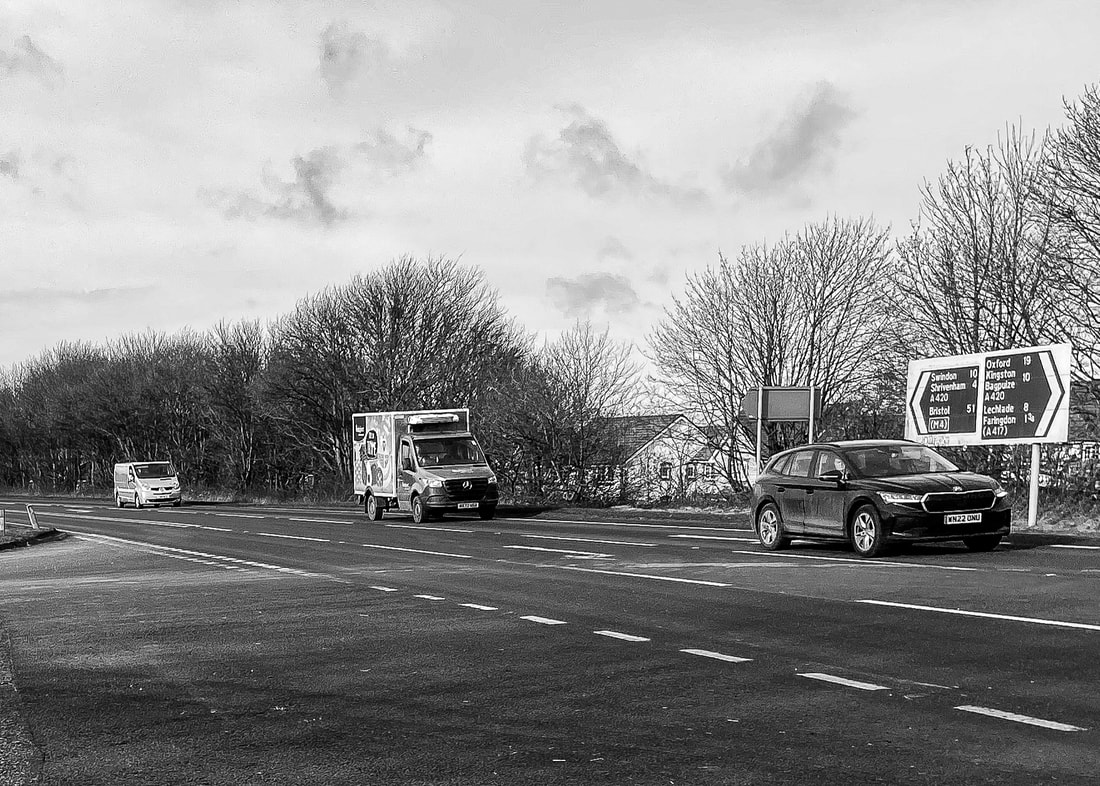
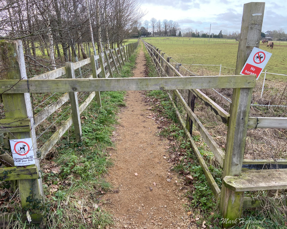
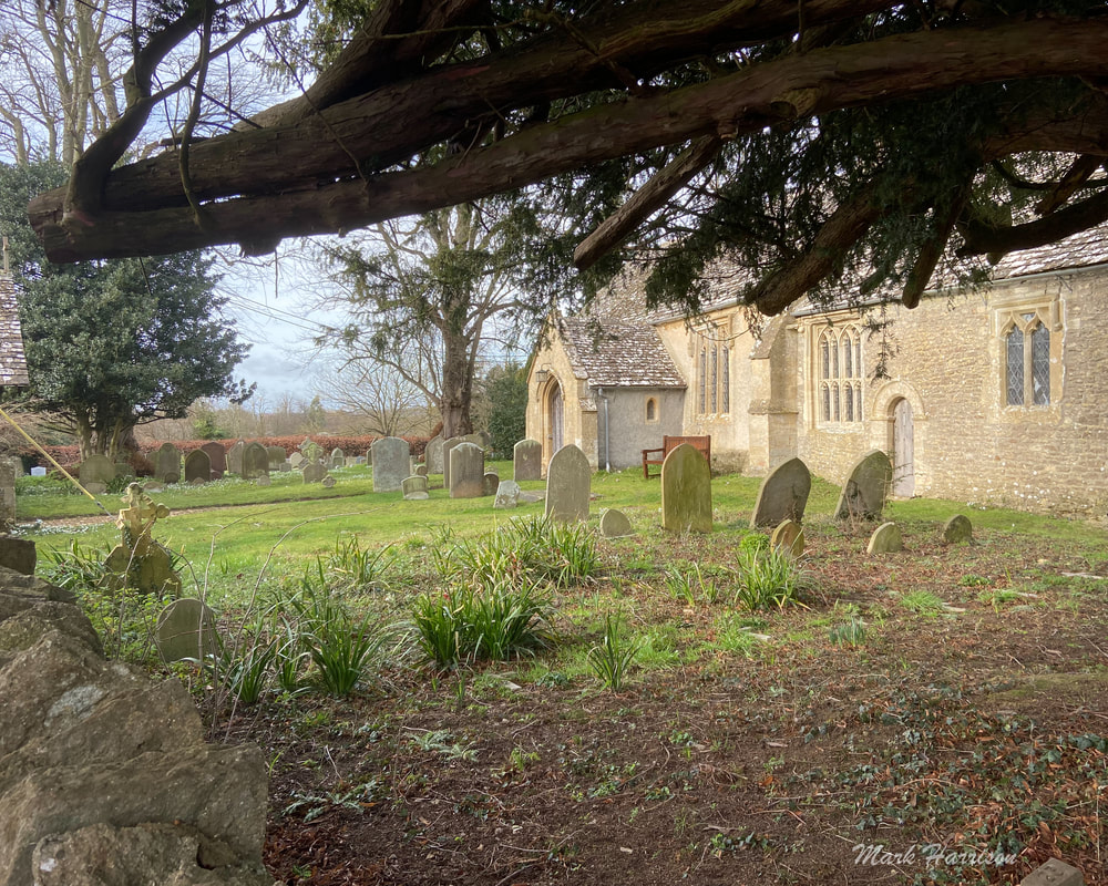
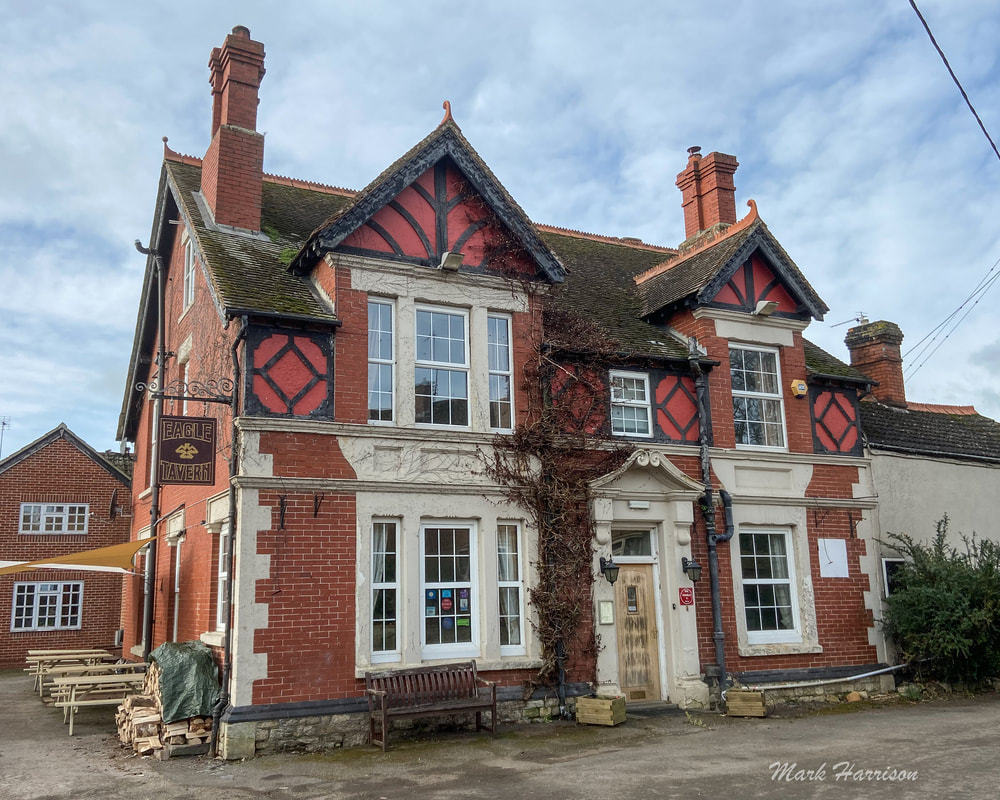
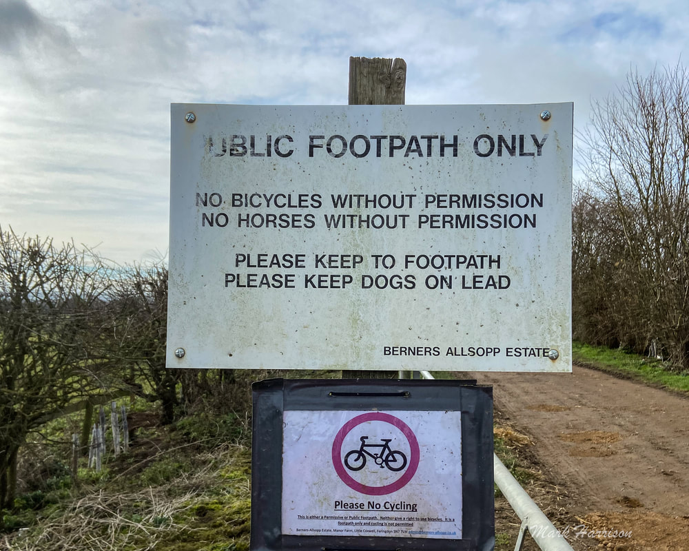
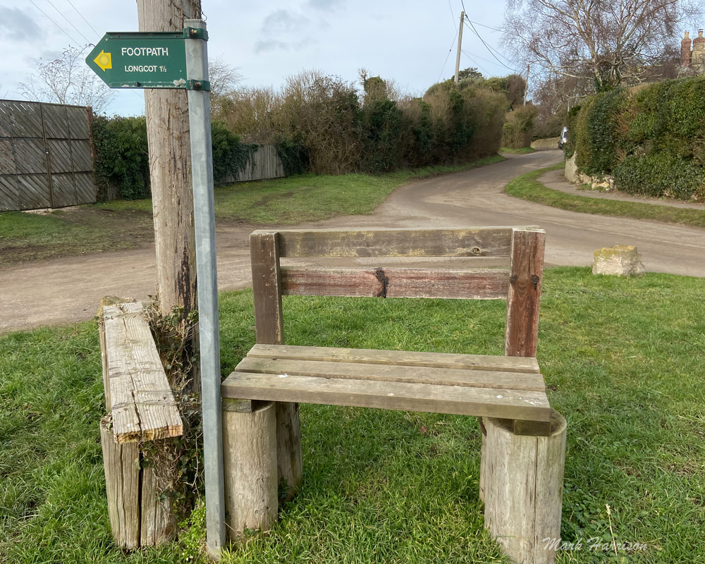
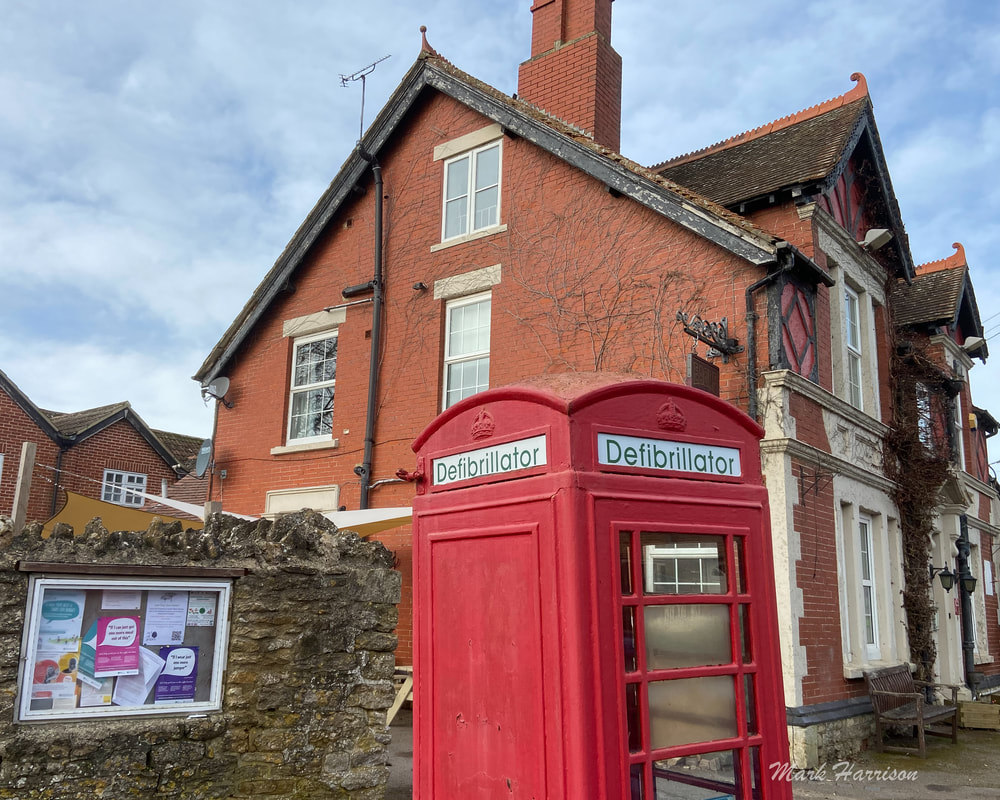
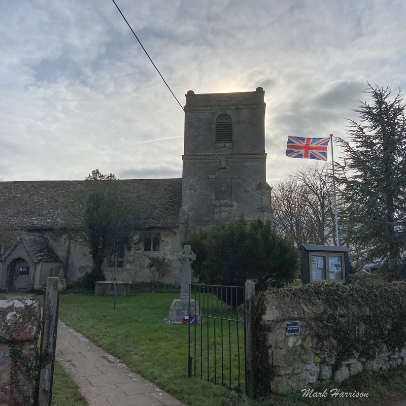
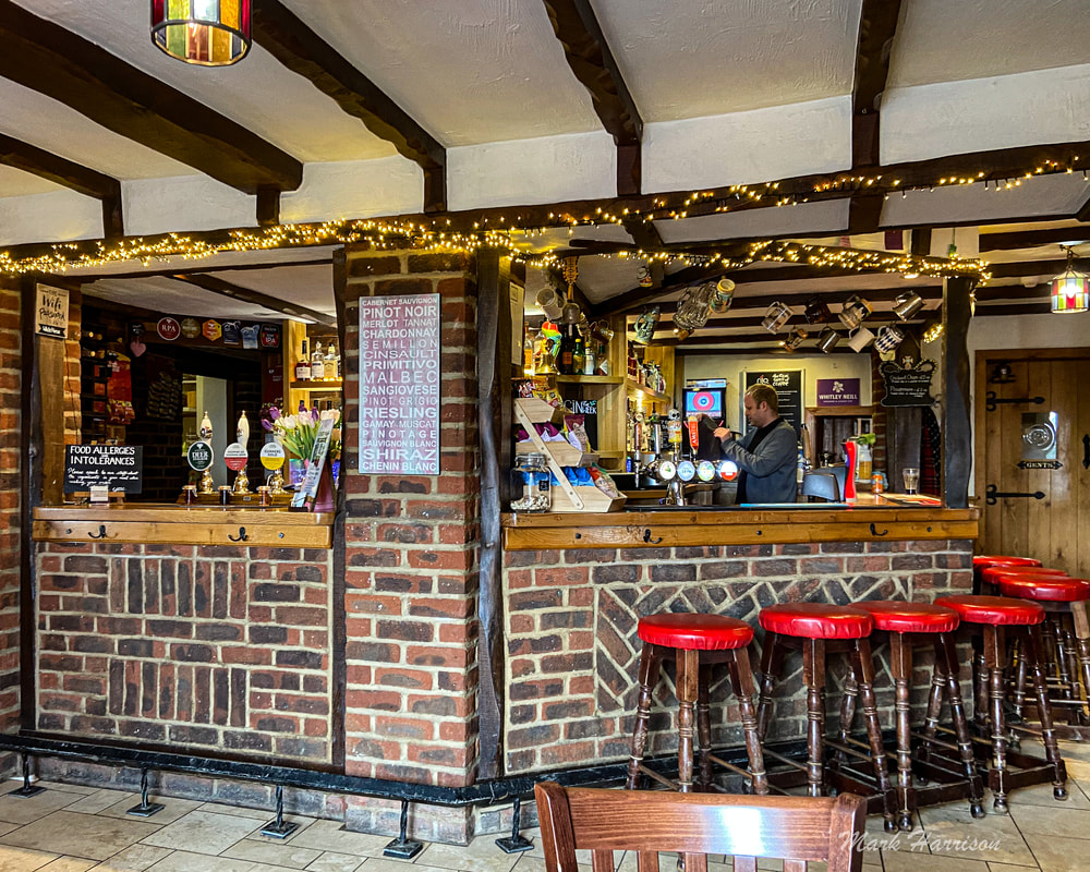
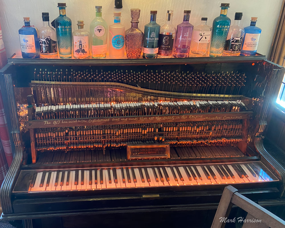
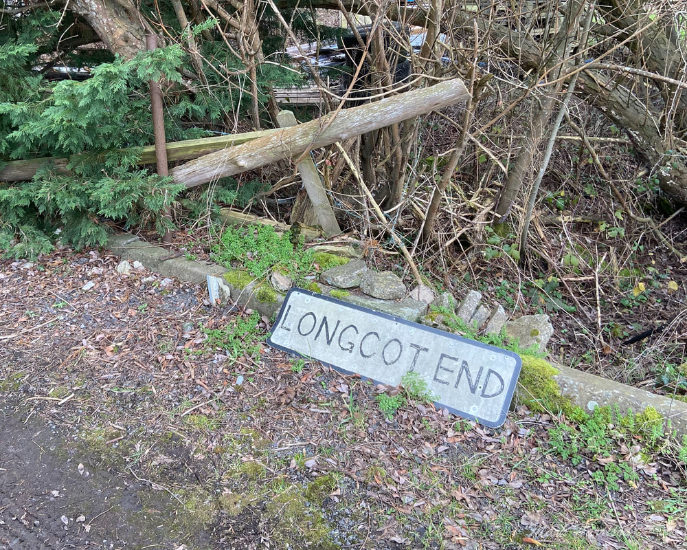
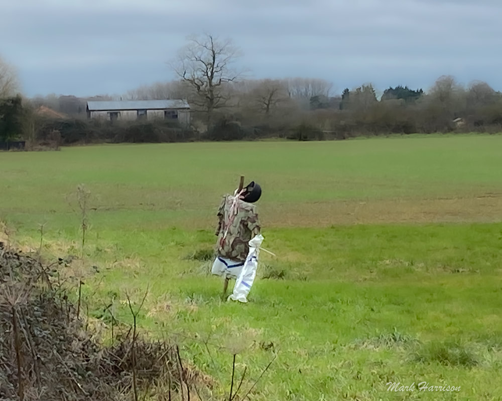
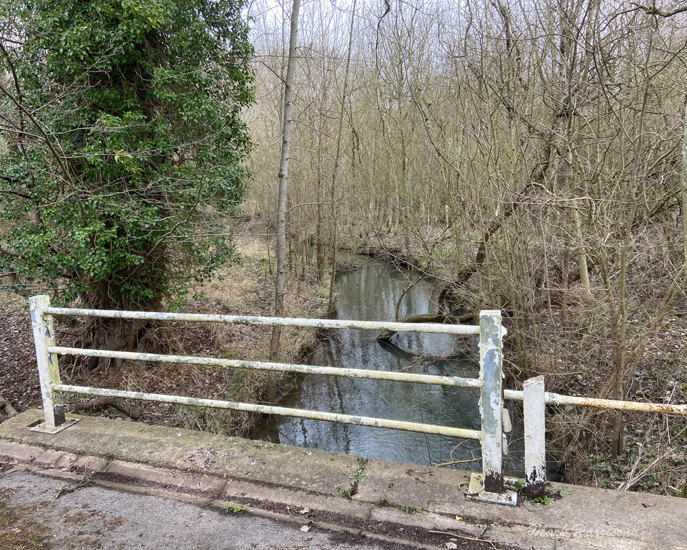
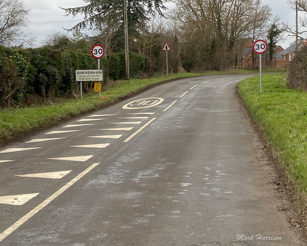
 Above: not quite Midwinter any more but near enough, as the soft light testifies. Nearing Longcot with the hills of the Berkshire Downs in the background. What could be a more delicious thing to do towards the end of the deep midwinter than to take a stroll in the gorgeous Oxfordshire countryside? Especially if the walking is to be punctuated with the refreshments that have traditionally been offered by local and countryside pubs? There was a time when this landscape was criss-crossed by roads and paths almost entirely devoted to walkers. The occasional horse rider might trot by, often with a cheery wave. Maybe a carriage or wagon would provide some sort of diversion. In the late 19th and early 20th century some bicycles would have emerged. The biggest risk for the walker might have been an angry bull (or cow), although laid hedges would have provided some protection for strolling travellers who stuck to the roads. This idyll persisted, anecdotally at least, until the mid 1930s when author, Laurie Lee, set out to walk from his village in the Western Cotswolds to London and then across Spain[1]. His recounting of his adventures must have inspired generations to follow in his footsteps, even if only metaphorically. He could even have journeyed through Faringdon in his wanderings. In this spirit I set out a few days ago to walk a paltry 7 miles from my home to Shrivenham, noted for its military college but also for having a couple of pubs and a handy bus stop for my journey home. Before that, a pub lunch and pukka beer were essential requirements en route. The interim target: The King and Queen at Longcot. But first a major obstacle Where once a stroll from Faringdon to Little Coxwell and Longcot beyond might have encountered a little traffic, active travellers have, for many years now, been confronted by the A420 bypass. A bypass that has seen a significant number of fatalities, at least two of them the deaths of pedestrians. Above: The longest I have waited to cross the A420 at this point (walking or cycling) has been 15 minutes. I would like to be able say there are other, easier places the cross but there aren't. Once upon a time, Faringdon had its own railway station. The buildings are still there forming part of the Old Station Nursery but the actual railway lines were dismantled some time after finally being decommissioned for freight in 1963[2]. In 1979 the A420 Faringdon bypass was opened. This wasn't necessarily a bad thing but why on earth didn't someone have the foresight for a pedestrian crossing or two. The perfect opportunity existed where it crossed paths with the now dismantled railway line, whose remaining embankments and cuttings provided ideal potential for active travel to Fernham, Little Coxwell and Uffington. It would have been so easy for the A420 to pass over a small tunnel. With that chance missed lobbying has continued in fits and starts during the ensuing 43 years for one or two safe crossings but none has found favour with the Oxfordshire County Council (OCC). Essentially, the Faringdon residents' area to roam safely has been cut in half. Especially as this is the only stretch of single carriageway between Swindon and Oxford where the speed limit increases bizarrely from 50 to 60 mph. Onwards and outwards So, having taken my life in my hands at the Fernham "crossing" and stumbled along the impromptu roadside verge for a few hundred yards, it was bliss to enter the footpath network en route to Little Coxwell. Above (clockwise from top left): lovely path but not the most comfortable barrier for tallish over 70s strollers (or for children on Shetland Ponies for that matter); I'd never seen the Little Coxwell church before; had frequently seen the inside of the Eagle Tavern though but 'twas a little early for lunch; does the repurposing of the phone box say anything about the goings on in the Eagle?; repurposing the order of the day with a welcome seat before the next inter-village section; a bit harsh given the evidence of hoof marks, some of the jiggery pokery with the footpaths and the somewhat arbitrary closure of the lane at the Longcot end. I was on foot anyway so could veer across country, so merely an academic observation. 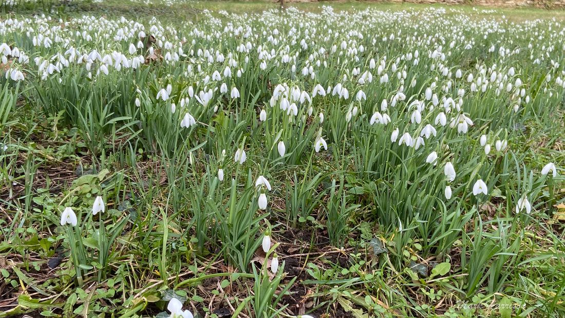 Above: Ah, snowdrops! - they were everywhere but not always this easy to photograph. It is a mightily pleasant stroll from Little Coxwell to Longcot. The surface was a bit of a curate's egg[3] but nothing a decent pair of walking boots couldn't cope with. The pub was beginning to beckon but there were a few more obstacles to overcome before getting there. Especially if rather naïvely following all the rules. Above (clockwise from top left): The "official" footpath leaves the road here rather unnecessarily I found; thereby forcing you over a stile the the BFG[4] might take in his stride but this geriatric found a bit of a stretch; only to end up having to traverse an ankle-crunching patch of weeds before returning to the road again; after being lulled into a false sense of security for a while, one field was a quagmire after being ploughed up without the path being made good again (as some more diligent landowners do); it was clear that horses had been making the best of even the good bits; a lovely clear run into the Longcot Village. None of these minor inconveniences would deter me from traversing this walk time and again in the future, especially with the treasure at the the end of this stage. Just wear suitable footwear and be prepared to remove platforms of mud from your soles after leaving the ploughed field. It might seem petty even to mention this stuff but we need to remind ourselves that many of these paths are rights of way that have been around for centuries and need to be respected. Longcot itself is a fairly unremarkable village but every place has its eccentricities: Above (l to r): Answers on a postcard?; Just why?; church and flag? I finally arrived at what I believe to be a jewel in the crown, the King and Queen. I have been there many times in the past 36 years I have lived in the area, mostly by car or by bicycle but I think this was only the second time I had travelled there on foot. The pub hasn't always been perfect as landlords have come and gone but I hope this one tarries awhile. It is just a thoroughly decent pub that serves up simple pub food ... delicious without too many pretensions. A gargantuan piece of fish moist and tasty on the inside, enveloped in the crispiest batter for instance. But it's the staff that make it special. Friendly and attentive without being smothering. Efficient when it's a replacement pint you're wanting. And the pints are good too, Rather too good in my case. I think I started with a pint of Ramsbury Deerstalker, at 4% ABV a sneaky temptation that ensured I had another ... I was sad to leave but I had to press on to Shrivenham where I would catch a bus back to Faringdon. Yes, I know it's in completely the opposite direction but the town had two pubs to try and a bus stop. Above, King and Queen (l to r): it would be rude not to; just a plain and simple quality pub; we once had to get rid of our piano - no-one wanted to buy it so it got donated, I forget to where - this seemed like a happy home for someone's instrument And so I had to move on. Another town, another pub, another pint. I hit the road with some apprehension. I'd cycled the stretch from Longcot to Shrivenham many times. It would've typically taken me 10-11 minutes. And now recovering (hopefully) from long Covid it was going to take me the best part of an hour. The roadside scenery is beautiful but a little monotonous on a bike. Why was I attempting to walk the same course? There were no handy footpaths to break the monotony or steer me away from the occasional (or not) speeding car. The contemplated pint in the Prince of Wales or Barrington Arms? Seemed a noble goal. The journey seemed to take ages and then it didn't. I arrived in Shrivenham still undecided as to whether to make for the PoW or the BA. To be honest, I didn't really fancy another pint. A quick check of the bus timetable indicated a voiture along in 5 minutes. I took the gap. Above: (top row l to r) leaving Longcot on a long and not very winding road; looking back after what seemed like an eternity; looking forward; this fella, dressed in military garb, was a sign of hope that Shrivenham was at hand; (Bottom row, l to r) someone's dream, maybe it won't look quite so bleak one day; semi-duel - do these guys speak to each other?; this pretty brook flows from the Berkshire downs and its water eventually gets to the ocean in the North Sea; are we nearly there yet?
OK so I failed at the last hurdle but it was only beer. I could go home and have some wine. Only I didn't. I was too knackered. But already looking forward to the next expedition. [Endnotes]:
|
AuthorAn avid cyclist and walker campaigning for access to all essential amenities within 15 minutes without a car or van Archives
May 2023
Categories |


 RSS Feed